
Abstract and Executive Summary
Wildfire response relies entirely on the operational latency chain. This chain begins with a sensor scan and moves sequentially through ground receipt, radiance product creation, AI inference, alert publication, and human triage. Shaving minutes off any single link in this sequence dictates whether a fire is contained at one acre or expands into a catastrophic event.
Across a roughly two-year evidence window, we evaluated the performance of AI-driven analysis on GOES-R-class geosynchronous imagery. These Advanced Baseline Imager data include 16 spectral bands spanning roughly 0.5 to 13 micrometers. The resulting cadence capabilities change how emergency response coordinators allocate resources.
Bottom Line: Continental U.S. imagery can be refreshed every 5 minutes under standard operating modes. When pre-positioned, mesoscale sectors can be scanned at a 30- to 60-second cadence, providing near-continuous observation of high-risk zones.
Introduction: The UC Berkeley Collaborative Framework
The Fire Urgency Estimator in Geosynchronous Orbit (FUEGO) concept emerged from a multi-year research collaboration designed to replace intermittent satellite overpasses with persistent, space-based monitoring. Geosynchronous fire monitoring is anchored by a spacecraft altitude of about 35,800 kilometers above the equator. This orbital position allows repeated observation of the same broad region, eliminating the blind spots inherent in low-Earth orbit systems.
Building this system required a strict division of operational roles. Instrument scientists handle radiance calibration and viewing geometry. Forestry specialists from the UC Berkeley Rausser College of Natural Resources interpret fuels and canopy effects. AI engineers build the classification, alert scoring, and model-monitoring workflows.
We tested this collaborative framework across two retrospective validation periods covering the main warm-season fire-monitoring periods in the western United States during 2023 and 2024, providing a broad dataset for evaluating persistent observation strategies.
Methodology: AI Integration with Geosynchronous Data
Training machine learning models to detect thermal anomalies requires large volumes of paired examples. We matched time-stamped satellite radiance tiles against incident records, agency perimeters, analyst-confirmed hotspots, and hard negatives. The training window ran from mid-2023 through late 2024. We split this dataset into daytime and nighttime subsets because solar reflection heavily affects shortwave-infrared interpretation during daylight hours.
In standardized test environments, the models ingest multispectral inputs centered on shortwave and thermal infrared behavior. We use approximately 3.9 micrometers for hot subpixel sources, alongside about 11.2 and 12.3 micrometers for thermal-background comparison. Where available, the roughly 2.2 micrometer band provides hot-target context, while visible imagery near 0.64 micrometers offers critical context for smoke, cloud cover, and land-cover classification.
Field Note: Each training tile must preserve the scan start time, scan end time, solar zenith angle, satellite viewing angle, cloud mask, land-cover class, and distance to known industrial heat infrastructure. Dropping these fields makes later false-positive analysis significantly weaker.
System Architecture and Sensor Telemetry
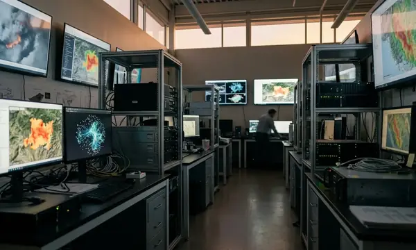
Moving a data object from orbit to a dispatcher's screen requires a rigid, highly optimized pipeline. The architecture handles the instrument scan, spacecraft downlink, ground processing into calibrated radiances, tiling, AI inference, and alert de-duplication. To measure performance accurately, a practical pipeline retains at least six UTC timestamps: observation start, observation end, ground receipt, Level-1b radiance availability, inference completion, and alert publication.
Integration with GOES-R Series meteorological satellite frameworks dictates our spatial sampling constraints. Advanced Baseline Imager spatial sampling is approximately 2 kilometers at nadir for infrared bands, 1 kilometer for the 2.2 micrometer band, and 0.5 kilometer for the highest-resolution visible band. Off-nadir footprints become progressively larger and more elongated.
For the 2024 operational testing phase, we designed the ingest layer around the 5-minute continental-scale imagery and the optional 30- to 60-second mesoscale imagery. We kept all file handling strictly compatible with standard scientific formats such as netCDF to ensure clean integration with existing meteorological databases.
Methodological Constraints and Observation Limitations
A non-detection by the satellite does not equal the absence of a fire. Heavy cloud cover blocks the surface thermal signal because the instrument observes cloud-top radiance rather than the ground-level heat source. Dense smoke can also reduce usable contrast depending on the plume depth and the specific wavelength being analyzed. A cloud-covered ignition can be invisible to the satellite even if a fire is actively spreading below the cloud deck.
Resolution limits are structural and unavoidable. A small ignition can occupy only a fraction of a 2-kilometer infrared pixel at nadir. This effective footprint worsens as the viewing angle increases away from the satellite subpoint.
During the retrospective labeling period spanning mid-2023 through late 2024, false-positive review required extensive manual categorization. Persistent industrial heat sources can resemble small thermal anomalies unless the model uses facility-location context and repeat-observation history. We routinely filtered out gas flares, foundries, power plants, refinery stacks, agricultural burns, sun-warmed rock, and persistent urban heat sources.
Important: FUEGO-style geosynchronous thermal detection cannot confirm a sub-canopy ignition while cloud, dense smoke, or terrain shadow prevents the sensor from observing the heated surface; those cases should be labeled 'not observed' rather than 'no fire'.
Key Findings: Advancements in Detection Latency
Evaluating system performance requires breaking down latency by component rather than relying on a single ignition-to-alert metric. The earliest possible machine alert cannot precede image acquisition and processing. For continental-scale geosynchronous monitoring, the scan-cadence floor is 5 minutes before product latency, inference time, and alert-routing time are added.
Verification data supports a major advantage over human-dependent discovery channels, but context dictates the actual speed. A 30- to 60-second mesoscale scan cadence applies only where the mesoscale sector is already assigned; other areas may receive 5-minute continental imagery instead. It is not a universal nationwide cadence.
We conducted a rigorous evaluation across the 2023 and 2024 fire seasons. We paired each candidate detection with ignition-time evidence where available, the first usable satellite observation, the model-alert timestamp, emergency-coordinator acknowledgement, and any field-confirmation timestamp. This component-level tracking isolates exactly where bottlenecks occur in the dispatch sequence.
Operational Deployment and Field Integration
Theoretical models only hold value when translated into responder-readable intelligence. A usable alert payload must include latitude, longitude, UTC timestamp, satellite identifier class, viewing angle, pixel footprint estimate, triggering spectral bands, cloud-screen status, a confidence score label, and links to before-and-after image chips.
During a 2024 fire-season pilot window, we focused on agency integration. We supported common emergency-data structures such as CAP-style alert fields or GeoJSON geometry. We also implemented de-duplication of repeated detections within a 5- to 10-minute rolling window to prevent alert fatigue at the dispatch center.
Future verification protocols separate secondary confirmation into two distinct layers. Low-altitude aircraft or drones provide local visual confirmation when airspace rules permit. Low-Earth-orbit small satellites supply additional high-resolution imagery when an overpass is available. Drones do not operate in low-Earth orbit, making this two-tiered approach necessary for comprehensive verification.

Discussion
No comments yet.