

Contents
- Executive Summary: Rapid Intelligence for Incident Management
- The Challenge: Blind Spots in Traditional Fire Mapping
- The Solution: FMS-200 and FUEGO Integration
- Multi-Spectral Data Acquisition and Characterization
- Delivering Actionable Intelligence via Airborne FOBS
- Results: Accelerating Emergency Response
- Sources & References
Executive Summary: Rapid Intelligence for Incident Management
The useful measure of an aerial fire-mapping system is not the sensor specification. It is how quickly an Incident Management Team receives a geolocated heat picture it can use during command, operations, planning, and air operations review.
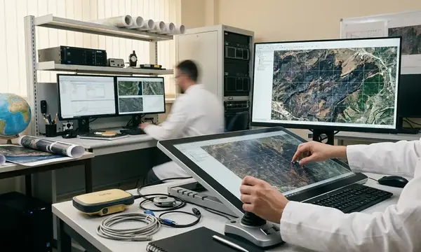
The response concept here puts incident staff first. The aircraft collects thermal and visible-band observations, the FMS-200 aerial mapping payload structures the imagery, and FUEGO performs automated wildfire detection to extract hotspots and support map generation. The primary deliverable is a geolocated hotspot and perimeter-change map, not a folder of imagery waiting for interpretation.
Operational handoff target
For fast-moving incidents, the handoff needs to fit inside the same operational period. In practice, that means delivery during a roughly 0- to 12-hour incident-planning cycle rather than waiting for a next-day perimeter update. That timing changes the product from a historical record into a planning input.
- Incident command gets current perimeter-change context.
- Operations can compare new heat against crew locations and branch assignments.
- Planning can update the map package before the next briefing cycle.
- Air operations can review heat signatures against aviation tasking and access limits.
Bottom Line: FMS-200 paired with FUEGO is strongest when treated as an incident intelligence pipeline, not as a standalone aerial camera mission.
Rapid deployment hardware
The deployment advantage comes from a patented wing strut clamp attachment designed for compatible Cessna airframes. It avoids cutting a camera port into the fuselage, which removes one of the slowest barriers in conventional aircraft preparation. That does not make aircraft release automatic, but it does reduce the amount of heavy modification normally associated with specialized mapping cameras.
The Challenge: Blind Spots in Traditional Fire Mapping
Traditional aerial reconnaissance often arrives late relative to the decision cycle that matters most: the first operational shift through the next planning cycle, commonly the first 0- to 24-hour period after detection or major growth. In that interval, crews need current heat location, flank movement, and spot-fire confirmation while the fire is still changing faster than the map package.
Where stale perimeter data breaks the plan
A perimeter flown or digitized during the previous shift can miss new runs, slop-overs, or spot fires that emerge before the next briefing. On one typical extended-attack pattern, the morning map shows a contained-looking flank, but afternoon wind pushes heat across a drainage. If the next crew assignment still follows the morning line, the field supervisor walks into a map assumption, not a fire edge.
Monitoring data shows that the practical failure is not always detection. The failure often occurs when incident staff allocate crews, dozer lines, aircraft, or evacuations against stale fire-edge assumptions during fast spread conditions.
Aircraft readiness is part of the sensing problem
Standard aircraft can carry observers, but specialized mapping cameras introduce a different constraint. Conventional installations may require window ports, belly mounts, engineering review, or aircraft-specific modifications before flight use. Those tasks compete with maintenance release, pilot availability, and airspace coordination.
The technical comparison is blunt: a sensor that can see heat but cannot fly during the current planning window delivers less operational value than a simpler package that reaches the incident in time. That trade-off shapes the FMS-200 and FUEGO pairing.
Important: A rapid map is not operationally useful if incident communications cannot ingest the product into the command mapping workflow before assignments are issued.
The Solution: FMS-200 and FUEGO Integration
The integrated approach uses the FMS-200 aerial mapping system to capture wildfire imagery and FUEGO to perform automated detection and support geolocation of thermal detections. The aircraft becomes a collection platform. The detection layer turns sensor output into mapped intelligence.
Deployment sequence
Human validation in the loop
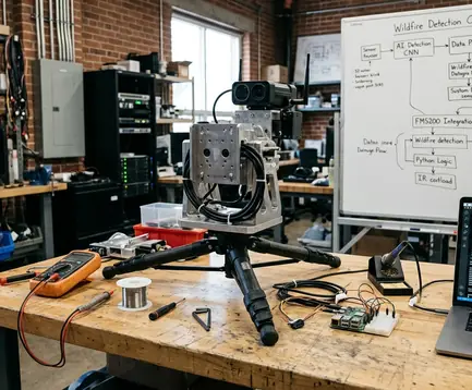
- Confirm that the assigned airframe is a Cessna 206, Cessna 208, or Cessna 182.
- Inspect the patented wing strut clamp and verify maintenance release requirements.
- Attach the windowless FMS-200 payload with payload clearance confirmed.
- Run sensor alignment checks before flight.
- Synchronize GNSS/INS data for geolocation support.
- Verify camera triggering and data-link readiness.
- Feed the imagery stream into FUEGO for hotspot extraction and map generation.
Verification data supports this sequence because each step protects a different failure point. Clamp inspection protects aircraft safety. Sensor alignment protects image geometry. GNSS/INS synchronization protects geolocation confidence. Camera trigger verification protects coverage continuity.
Compatibility boundary
The rapid-mount approach is constrained to eligible Cessna 206, 208, and 182 airframes with inspection-confirmed strut geometry, payload clearance, and maintenance release. That caveat matters. A system designed for standardized deployment loses its speed advantage if teams try to improvise it onto an unconfirmed aircraft during an active incident.
When an eligible airframe, trained technician, and inspected clamp kit are available, same-day aircraft preparation becomes realistic. When any one of those is missing, the limiting step shifts to aircraft access and maintenance release. The hardware shortens the path; it does not erase aviation discipline.
Multi-Spectral Data Acquisition and Characterization
Multi-spectral fire mapping separates visible fire context from thermal evidence. Visible-band imagery supports terrain, smoke-column, road, and structure interpretation. Infrared imagery identifies heat signatures that visual observation can miss, especially under smoke canopy or during night operations.
What each band contributes
- Visible-band imagery: road access, ridgelines, structures, smoke-column direction, retardant lines, and terrain context.
- Infrared imagery: active flaming fronts, isolated hotspots beyond the mapped edge, residual heat in heavy fuels, and thermal anomalies under smoke.
- Paired interpretation: a heat signature gains operational meaning when mapped against slope, access, fuels, and crew position.
The mapping payload uses medium-format specialized aerial cameras configured for high-resolution wildfire mapping rather than general scenic reconnaissance. That distinction matters in dense smoke. A scenic image can look impressive and still fail to locate a hidden thermal pocket behind the head of the fire.
Night collection and smoke-obscured heat
Infrared collection can work during the roughly 1800-0600 local period when visible-only observation is limited. Night operations often improve thermal contrast, but they also restrict visual terrain interpretation and can reduce aircraft availability. The better operating model pairs thermal detection with technician review instead of assuming that hotter pixels automatically equal better decisions.
Dense convective smoke, steep terrain, or aircraft stand-off distance can reduce confidence in hotspot geolocation even when infrared signatures are visible. The implication is operational, not academic: the map should carry enough annotation for ground coordinators to distinguish confirmed heat from lower-confidence thermal evidence.
Field Note: The most useful thermal marks are the ones tied to a tactical question: new spot fire, active flank, retained heat near control line, or change from the last perimeter.
Delivering Actionable Intelligence via Airborne FOBS
Airborne FOBS technicians validate what the automated system detects. They review sensor output, compare detections with fire behavior cues, confirm map annotations, and transmit the resulting Aware® products to the roles that can act on them.
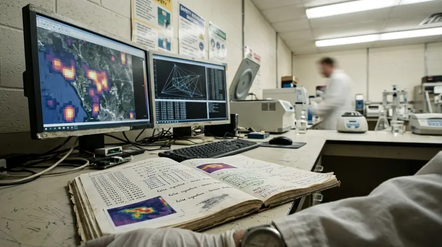
The service relies on technicians with experience logged at about 15 years or more. That experience is not decorative. The technician watches for the difference between a meaningful heat source and a misleading signature near smoke, terrain shadow, or residual burn. FUEGO accelerates detection; the Airborne FOBS workflow turns detection into field-ready intelligence.
The product set includes the Aware® perimeter layer, change-detection overlay, geolocated hotspot map, and annotated observation notes. Recipients can include incident command, planning, operations, air tactical coordination, evacuation coordination, and field supervisors. Delivery can occur during the active flight or shortly after landing, depending on bandwidth, aircraft communications, and the incident data-ingestion process.
Transmission discipline
The handoff should follow a simple rule: send the smallest complete product that answers the operational question. A ground coordinator does not need every frame from the flight when crews are waiting for an assignment. They need the current heat location, confidence context, perimeter change, and timestamp.
- Confirm the intended recipient role before transmission.
- Attach map layers in the format the incident can ingest.
- Include observation notes where confidence varies.
- Record delivery timestamp and recipient acknowledgment.
- Preserve the flight date range, aircraft model, sensor configuration, and technician signoff for later review.
This is where many technically strong missions lose value. The aircraft sees the heat, the model detects it, and the map exists, but the product misses the assignment cycle. Airborne FOBS work should close that gap.
Results: Accelerating Emergency Response
The result to track is elapsed time from airborne thermal observation to delivery of a usable hotspot or perimeter-change map to incident staff. That metric keeps the evaluation tied to emergency response, not image quality alone.
Decision points affected
During active growth from the first attack shift through the first 72 hours of extended attack, per standard references, perimeter uncertainty can change tactical risk faster than the briefing rhythm. Current AI-supported triangulation affects crew assignment, aviation tasking, dozer-line placement, structure-protection prioritization, evacuation-zone review, and night-shift briefing updates.
Stress testing revealed the main safety mechanism: fewer crews are sent toward unverified fire-edge assumptions when current hotspot and spread-direction evidence is available. The point is not to replace fireline judgment. The point is to keep the map from lagging so far behind the fire that field judgment starts from the wrong premise.
Resource allocation impact
Verified AI triangulation gives emergency response coordinators a cleaner basis for choosing where scarce resources move next. A mapped hotspot outside the prior edge can justify aviation review. A stable cold flank can keep crews from overcommitting to a low-value segment. A change-detection overlay can show whether a dozer line is still ahead of the heat or already behind it.
Bottom Line: The strongest operational gain is speed with traceability: a current heat map, tied to sensor evidence, delivered inside the planning window.
Sources & References
The evidence base for this workflow should draw from interagency aerial reconnaissance practice, incident command mapping requirements, and peer-reviewed work on infrared and multi-spectral wildfire detection. The National Interagency Fire Center (NIFC) remains the appropriate starting point for interagency wildfire aviation context, reconnaissance coordination, and incident data practices.
Academic Sources
Peer review indicates that infrared and multi-spectral imaging remain central to wildfire detection, smoke-obscured thermal mapping, and geospatial hotspot characterization. The most relevant literature from 2021-2025 focuses on infrared wildfire detection, multi-spectral fire characterization, smoke-obscured thermal imaging, and geospatial hotspot mapping. Federal research programs on automated wildfire detection systems provide useful context for sensor and model evaluation.
Validation checklist for case-study use
- Confirm aircraft model as Cessna 206, Cessna 208, or Cessna 182 before assigning the rapid-mount kit.
- Record clamp inspection, sensor alignment, GNSS/INS synchronization, and camera trigger verification before takeoff.
- Capture visible-band and infrared imagery for paired interpretation.
- Retain flight date range, aircraft model, sensor configuration, technician signoff, map delivery timestamp, and recipient acknowledgment.
- Document whether the product reached incident command, planning, operations, air tactical coordination, evacuation coordination, or field supervisors before assignments changed.
Use FMS-200 with FUEGO when the incident needs same-period hotspot and perimeter-change intelligence from an eligible Cessna platform. For fast-growth fires, that is the deployment model to standardize before the next smoke column appears.




Discussion
No comments yet.