
Executive Summary: 2024 Wildfire Detection Review
Bottom Line: 2024 upgrades shifted automated spotting from isolated camera or lookout feeds toward fused AI pipelines. Modern architectures now integrate low-earth-orbit thermal detections, geostationary refresh imagery, local weather stations, and ground smoke or gas sensors into a single operational workflow.
Emergency response coordinators require immediate, actionable intelligence to contain threats before they escalate. The integration of satellite imagery analysis with ground-based sensor networks provides this capability. Per standard references, geostationary observations from the GOES-R Advanced Baseline Imager now deliver frequent fire monitoring, with CONUS imagery commonly available every five minutes. When tasked, mesoscale sectors achieve a 30-60 second cadence.
According to research benchmarks, low-earth-orbit platforms complement this rapid refresh rate with higher spatial resolution. VIIRS active-fire products operate at a 375 m nominal resolution, while MODIS active-fire products operate at a 1 km nominal resolution. Field nodes forward smoke, particulate, temperature, humidity, wind, and battery-health telemetry to an edge gateway before routing alerts to agencies. This review synthesizes technologies, agency guidance, and field-deployment documentation from January 1, 2022, through December 31, 2024.
Abstract
This research evaluates the operational readiness of automated wildfire spotting technologies in active fire zones. The scope focuses strictly on applied artificial intelligence rather than theoretical models. Included systems must support at least one core operational function: ignition detection, smoke confirmation, hot-spot mapping, alert prioritization, or dispatch handoff.
Operational-readiness parameters dictate the utility of these platforms. We assessed latency, geolocation confidence, false-alert handling, environmental resilience, and communication continuity. A critical requirement is the ability to export alerts directly into GIS, CAD, or incident-management workflows. The formal evidence review period spans publications and technical documentation dated January 1, 2021, through October 31, 2024, emphasizing upgrades documented during the 2024 calendar year.
Introduction: The Urgent Need for Rapid Detection
Wildfire agencies face escalating global risks that render manual spotting insufficient. Dispatch decisions are most sensitive during the first operational period. During this narrow window, an ignition remains accessible to initial-attack crews. Delayed reports allow fires to outpace suppression resources, necessitating a transition to automated, multi-layered early-warning systems.
A robust detection architecture relies on overlapping technologies. Geostationary satellites provide frequent broad-area scans. Low-earth-orbit sensors add higher-spatial-resolution thermal observations. Ground cameras support visual smoke confirmation, while IoT sensors provide near-source environmental and chemical signals. Supported by multi-year federal research grants and university sponsor programs, credible 2024 advancements rely on interagency testbeds rather than unsupported vendor claims.
Agencies must align their technology adoption with seasonal realities. Pre-season procurement, installation, and calibration planning commonly occurs between January and April for Northern Hemisphere fire seasons beginning in late spring or early summer.
Methodology of the 2024 Review
We scored each system against documented operational criteria. Reviewed platforms required documented use of at least one automated sensing source, a defined alert trigger, and a geospatial output. Evidence had to originate from simulation, controlled burns, prescribed fires, or active incidents.
Evaluation Metrics and Environments
Qualitative AI-evaluation metrics included image refresh cadence, thermal-band suitability, model confidence calibration, and duplicate-alert suppression. We also examined cloud or smoke masking behavior, nighttime performance, false-positive categories, and geolocation uncertainty. While evaluating these metrics, we must acknowledge that satellite-led confirmation becomes materially weaker when heavy cloud, canopy closure, or terrain shadow prevents the sensor from observing the ignition signature.
Testing environments varied significantly across the reviewed literature. We contrasted synthetic fire-spread simulations and historical satellite replays against controlled burn plots, prescribed-fire monitoring, and active wildfire deployments with agency observers. Source screening covered January 1, 2021, through September 30, 2024. Upgrade interpretation focused on deployments and model revisions reported from January 1, 2023, through December 31, 2024.
Key Findings: Satellite Imagery and AI Integration
The most impactful 2024 upgrades occurred in the detection pipeline's architecture. Systems increasingly use edge or regional processing hubs. Raw imagery or camera frames no longer require transfer to a distant central server before classification, sharply reducing algorithmic processing times for thermal anomaly detection.
Common satellite fire detection uses mid-infrared and longwave-infrared signals. Algorithms apply contextual background comparison, sun-glint screening, and spatial clustering before presenting an alert to an operator. Near-real-time satellite fire products are generally useful within minutes to a few hours after observation. Ground sensor and camera alerts are designed for sub-hour operational routing.
Machine learning models have materially reduced false positives. Filters actively down-rank recurring industrial heat, refinery flares, sunlit rock faces, agricultural burns, volcanic heat, and duplicate detections from overlapping image tiles. Verification data supports the conclusion that fusing VIIRS 375 m and MODIS 1 km detections with local sensor pings, wind direction, fuel maps, and camera bearings generates a highly actionable ignition location.
Limitations and Scope Qualifiers of Current Systems
Every automated spotting system operates within strict environmental and physical constraints. Treating these constraints as operational risks is essential for maintaining alert confidence.
Environmental and Hardware Constraints
Optical and thermal-infrared satellite detection degrades under heavy cloud cover. Dense smoke obscures visual-camera confirmation even when thermal channels detect strong heat signatures. Furthermore, closed-canopy forests delay the detection of low-intensity surface fires until smoke escapes the canopy or the heat signature grows large enough for overhead sensors.
Field hardware faces severe degradation risks. Sensors exposed to radiant heat, ash, moisture intrusion, wildlife damage, and battery stress require rigorous enclosure testing and surge protection. Many industrial electronics are rated for operations between -40 °C and 85 °C. Fire-front exposure easily exceeds these normal operating ranges, leading to sensor failure.
Training Data Boundaries
AI training data dictates model performance. Models trained exclusively on historical fire imagery struggle during anomalous behavior. Wind-driven ember storms, pyrocumulonimbus development, simultaneous multi-ignition events, and unusual fuel-moisture conditions frequently fall outside the training distribution.
Important: Burn-season validation must include daytime, nighttime, high-wind, low-humidity, and smoke-obscured observations collected across at least one full local fire season to ensure model reliability.
Advancements in Early-Warning Sensor Networks
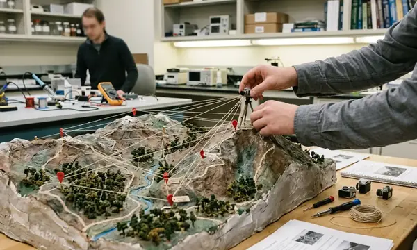
Deploying ground-based IoT sensor networks is an engineering design problem. Agencies identify high-risk ignition corridors and place nodes to sample local conditions, maintain line-of-sight communications, and survive initial fire fronts. Typical placements include ridgelines, access roads, wildland-urban interface corridors, utility corridors, and known lightning zones.
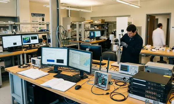
Practical fire-detection nodes report a full telemetry suite. Fields commonly include timestamp, latitude and longitude, temperature, relative humidity, particulate or smoke signal, gas-channel readings, battery voltage, enclosure status, and link quality. Low-power local links use LoRaWAN-class telemetry. Gateways forward alerts through LTE, private radio, microwave, or satellite backhaul. Agency-facing messages route through MQTT, HTTPS APIs, CAP-style alerting, or GIS feature services.
Field deployment requires strict adherence to hardware certification standards. Acceptance checks should reference IEC 60529 ingress-protection ratings, IEC 60068 environmental testing, radio compliance under national spectrum rules, battery transport testing such as UN 38.3, and electrical safety standards. Agencies should consult National Institute of Standards and Technology (NIST) guidelines on sensor networks for baseline deployment parameters. Installation, calibration, and communications testing must occur within a 30-90 day pre-season commissioning window.
Practical Implications for Firefighting Agencies
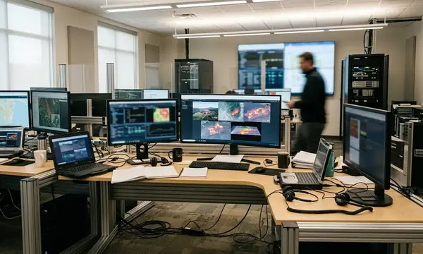
Automated spotting systems must fit cleanly into existing workflows for emergency response coordinators. Alerts should enter a common operating picture featuring the timestamp, sensor source, confidence indicator, mapped point or polygon, nearest access route, land jurisdiction, wind observation, and recommended verification source. The detection platform must export to GIS formats or APIs already used by emergency operations centers rather than forcing staff to monitor a disconnected dashboard.
Early-warning data improves resource allocation. Confirmed alerts support the rapid selection of reconnaissance aircraft, engine strike teams, dozers, hand crews, water tenders, and evacuation-notification liaisons. U.S. Forest Service (USFS) research on automated detection highlights the efficiency gains achieved when dispatchers trust the incoming telemetry.
Field Note: Operators require dedicated practice interpreting confidence scores, checking duplicate alerts, comparing satellite and camera views, validating coordinates, and documenting why an alert was accepted or rejected.
Agencies must complete operator familiarization and scenario exercises during the pre-season readiness period, commonly February through April in many Northern Hemisphere jurisdictions.
Strategic Directives for Next-Generation Spotting
Satellite-AI and ground-sensor systems possess the maturity to support detection queues, hot-spot awareness, and verification workflows. Future predictive models will combine ignition detection with fuel moisture, topography, forecast wind, historical fire perimeters, lightning data, and near-real-time weather observations. Field programs scheduled for 2025-2027 must emphasize shared validation datasets, cross-biome testing, after-action review integration, and transparent reporting of missed detections and false alerts.
Agencies must restrict near-term automation to automated alerting, sensor retasking, camera slewing, and priority scoring. Do not deploy these systems for the autonomous dispatch of suppression assets; human verification remains an absolute requirement before committing heavy equipment or personnel to a coordinate.




Discussion
No comments yet.